INTRODUCTION
Spread over the emerald waters of the Gulf of Tonkin, the legendary Ha Long Bay covers the regions of Ha Long city, the township of Cam Pha and a part of the island district of Van Don. The bay encompasses 1969 islands of various shapes and sides, 989 of which have been given names. The natural beauty of Ha Long Bay has long been praised and was first recognized as a World Heritage in 1994 by UNESCO. In 2000, UNESCO recognized it as a World Heritage for the second time for its geographical and geomorphologic values. This confirms the global premier value of Ha Long Bay.
Two main kinds of islands can be distinguished: Limestone and schist, which formation would date back to 250-280 million years ago. Viewed from above, Ha Long Bay resembles a geographic work of art. While navigating on the green clear water, you feel lost in a legendary world of stone islands, which shapes change depending on the angle and on the light. At the core of the islands, there are wonderful caves and grottoes to be discovered.
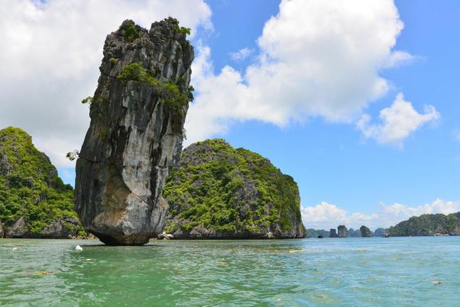
LIMESTONE ROCKFORMATION IN HA LONG BAY
Around the Gulf of Tonkin, famous for the three bays that are Ha Long Bay, Lan Ha Bay and Bai Tu Long Bay of which Bai Tu Long Bay is the biggest bay and Lan Ha Bay is the smallest one. Lan Ha Bay covers an area of 70km2 of which 54km2 is under the management of Cat Ba government, the rest belonging to Ha Long government. Ha Long Bay is more than 20 times bigger than Lan Ha Bay. The Bay covers an area of 1553km2 with 1969 islands in the bay. Even Lan Ha Bay is much smaller than Ha Long Bay. It is much nicer, because it is a much less touristy area which is perfect for swimming and snorkeling around secluded beaches.
Limestone rock formation around the bay is something that used to be mysterious. By some research that has just been carried out, it can be explained below. The procession of formation can be divided into three main steps below:
Sedimentary rock: This procession was formed for a long time under the earth and this is the beginning of the rock’s formation. It was formed by the tiny cells that come from the dead organisms including corals, oyster’s shell, clam’s shell, fish bones…. It was formed by layers set on each other and between the layers there is a thin connection of sand or mud.
Earthquake procession: Around 500 million years ago, there was a very big earthquake that happened around this area. The tectonic which came from the earthquake made the sedimentary rock come up. There were no islands at the beginning because the rock had a very flat surface. Because at the beginning the rock was young- quite smooth and floppy- it was easy to be eroded by the rain.
Rain erosion and the islands formation: By rain erosion, a huge rock was divided into thousands of islands. Many valleys, caves, grottoes and lagoons were formed, creating such beautiful landscapes you see nowadays. And also by the rain erosion made the bottom of the area always in a half round shape. That is why around the sides nearby the islands are always shallow and it is getting deeper like the shape of the half round.
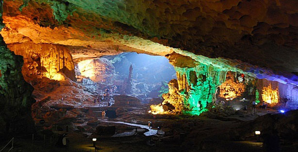 SUNG SOT CAVE
The Cave is situated in the centre of the UNESCO World Heritage area. It is known as Sung Sot Cave or Suprising Cave, located on Bo Hon Island.
Ascending to the cave, the way leading to the entrance is decorated by trees and plants. In the Cave, it is divided into two chambers, decorated by so many amazing stalactites and stalacmites, make the Cave become more atractive.
Archeaologists have ever done many researches and have found many evidences related to the pre-historic people
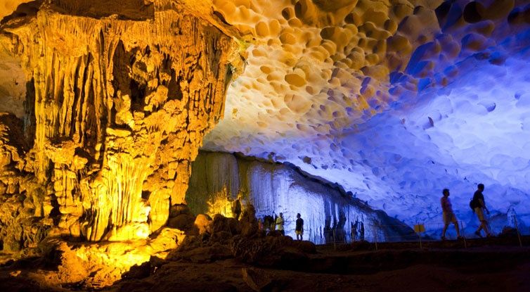 THIEN CUNG CAVE
It is located on the South-West site of the Bay, 4km away from the Wharf outside of Ha Long city. The way leading to the Cave is covered on the both sides by thick layer of tropical plants. After entering a narrow gate, it's 130 meters long girth opens up.Getting the Cave, you will be astonished in front of a very animated and splendid beauty made by stalacties holding on the ceiling and stalacmites growing up from the ground. On the East wall of the Cave, there is a grandiose and imposing picture with characters of tales.Going out of the Cave we have a sensation of just watching a unique. The Cave has been recently discovered and it is considered as one of the most beautiful caves in the Bay.
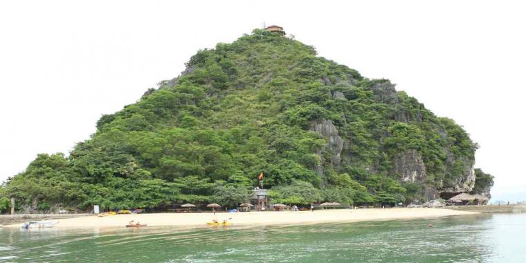 TITOV ISLAND
This is a very beatiful island with the two sides surrounded by a very big sandy beach. There is one stair-way leading to the top, from which visitors can have good views around both Ha Long Bay and LanHa Bay
It is located on the South-West of Ha Long city. On the 22nd of November 1962, the XoViet astronaut-Ghermann TITOV and Vietnam President HO CHI MINH came to visit the island. In order to memorized the visit, the Vietnam goverment named the island with the name-TITOV
 KETTLE ROCK
Am Rock(Ấm in vietnamese) or Kettle rock is situated in Bai Tu Long Bay. It was named Am following a popular story that is a teapot of Jade Emperor who accdientally dropped it into Ha Long Bay, so its handle was broken
.jpg)

.jpg)
(1).jpg)
TOURS IN HA LONG
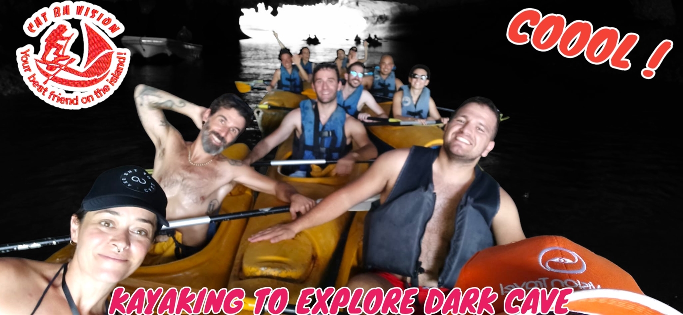
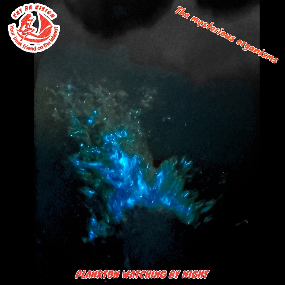
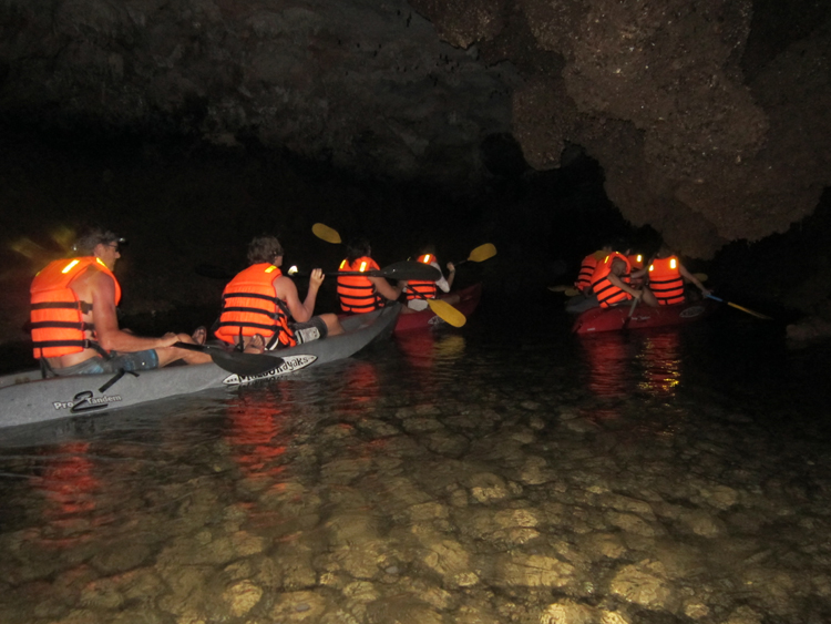
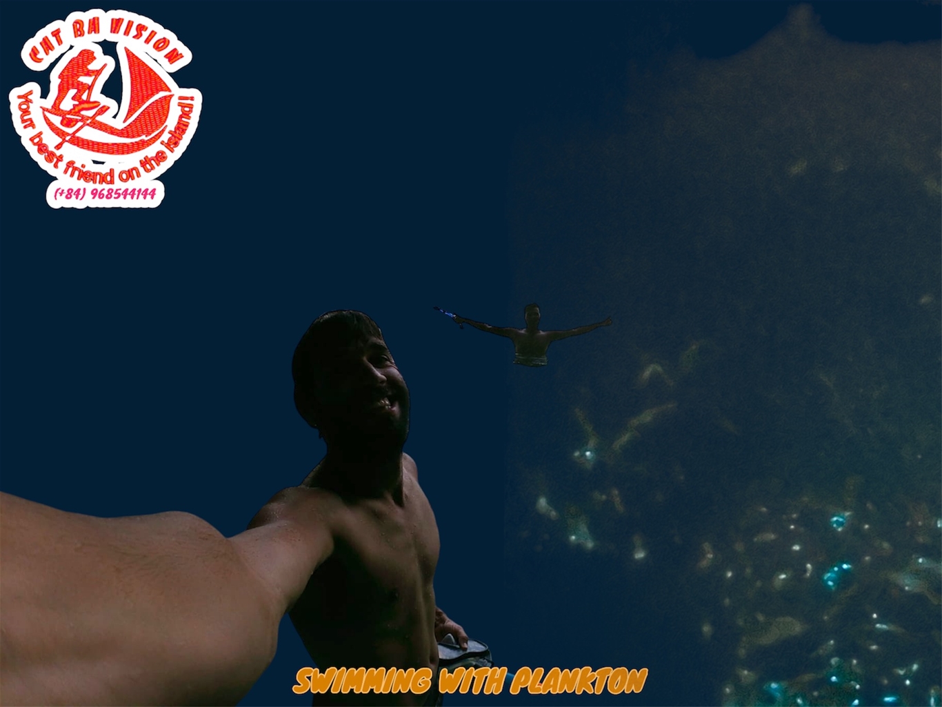 Starting the trip at around 8am from the office. Going through the floating fishing village. Keep cruising around Lan Ha bay for around 2 hours to enjoy hundreds of beautiful limestone islands before stopping to do one and a half hours kayaking trip through some caves to explore the hidden lagoons. Continue moving to explore the center part of Ha Long bay. Anchoring at a less touristy area to have seafood lunch on the boat. Keep moving to swimming area to enjoy swimming, snorkeling and relaxing at secluded sandy beaches. The boat trip fishes at around sunset.
ONE DAY/ONE NIGHT BOAT TRIP TO HA LONG BAY
We do the same one day boat trip and then change in to the sleeping boat or floating guest house to stay overnight on the bay. Sunrise breakfast with some free hot drinks and go back to Cat Ba at around 8am.
OVERNIGHT BOAT TRIP TO HA LONG AND BAI TU LONG BAY
DAY1: Get on the boat at around 8am or 10am. Enjoying the floating fishing village’s view from the boat. Cruising around Lan Ha bay for around 2hours before stopping at swimming area for swimming and snorkeling. Seafood lunch on the boat. Continue moving to the area which has some caves and hidden tunnels to do kayaking to explore the hidden lagoons. Keep cruising to explore Ha Long center. Anchoring at a calm and quiet area to stay overnight. Take part in fishing activity by dropping the fishing trap and fishing net for the next morning catching fishes.
DAY2: Wake up at 7am. Pulling the trap and the net out to catch fish and seafood. Then sunrise breakfast with some free hot drinks. Moving to explore the other part of Ha Long bay before exploring the beauty of Bai Tu Long bay. Stopping at really less touristy area which has beautiful sandy beaches to have seafood lunch on the boat, then go swimming and do snorkeling. Continue moving to explore the other part of Ha Long Bay before arriving in Ba Trai Dao for swim and stay overnight.
Day3: Sunrise breakfast with some free hot drinks. Moving to Dau be island to paddle through three tunnels to discover three hidden lagoons. Going to swimming area for one more time swimming, snorkeling. Going back to Cat Ba at around 5pm.
catbavision-your best friend on the island